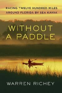
"WITHOUT A PADDLE: Racing Twelve Hundred Miles Around Florida By Sea Kayak" by Warren
Richey
The story of Sharkchow's 2006 participation in the Ultimate Florida Challenge. Coming
to a bookstore near you. June 8, 2010.
Publisher: St. Martin's Press
ISBN: 978-0-312-63076-8
320 pages, $24.99
Due in bookstores and on
Amazon.com
June 8, 2010.
|
$25.95 with FREE Shipping!
Jenning has a second version of the EPIC Ultimate Florida Challenge. This is a two
DVD set. The first DVD is the same as the first release. But the second DVD contains
two very interesting interviews.
First, SharkChow has a long interview giving many details and insights into his
impressive win of the first WaterTribe Ultimate Florida Challenge in 2006. His hint
about using the tides on the St. Marys river is worth the price all by itself if
you are thinking of doing the UFC yourself. Note: this is really a voice recording
- no video.
Next there is a shorter video interview of ThereAndBackAgain (aka TABA). TABA isn't
a complainer so he had never mentioned many of the real issues he faces in these
challenges. This interview opened my eyes and prompted some minimal changes to make
things just a bit more fair.
Special Note: The proceeds all go direct to Jenning. Making this DVD took untold
amounts of money and time. This would make a nice preview for the UF2010 event.
|
|
Enigma Log Book
Account of Wizard's participation
in the Inaugural Ultimate Florida Challenge
in Inigma, March 2006
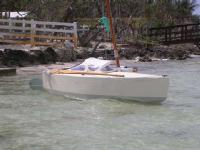
By Matt Layden (Wizard)
Being a transcript of the daily log of Enigma, 12' coastal cruising sailboat, during
the WaterTribe Ultimate Florida Challenge of March, 2006, interspersed with comments
and explanations from memory, December, 2009.
Note to the Format
You can click on each photo to get a larger view.
The logbook has pre-formatted pages, with a 2-line header as follows:
|
Time
|
Landmark
Lat
|
Bears
Lon
|
Distance
|
Course
Wind
|
Speed
Sea
|
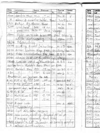
A Page From the Log
Each column is filled out with data matching ONE of the headers from that column,
it usually being evident from the value or units which type of data is in each entry.
For instance, the 5th line below can be read as:
"At 0845 o'clock, Anna Maria Key bears 060 degrees, distance 1.5 nautical miles
(data from eyeball observation implying a reduced precision). Wind is north-northeast
at 15 knots, sea from the northeast 1 to 3 feet."
A visual or compass bearing and distance to some charted feature or landmark is
a good old-fashioned way of describing your position. The other way is to fire up
the GPS or arrive at a navigational fix some other way, and note down your lat and
lon, but I rarely bother unless navigating in poor visibility or far from land.
The other data are mostly to memorialize conditions for future reference, though
it can be important if you need to reconstruct your recent movements in dead reckoning
piloting. I also try to remember to write in notes and commentary, following, or
instead of, the standardized data.
I'm not going to take the time to translate all my log entries to readable text
as above, I hope the cryptic log format will be good enough to give a rough picture
of what was going on aboard for anyone who may want to try to get something out
of it. Then I'll intersperse some other notes that didn't make it into the log as
I think of them. Here we go:
S/V ENIGMA from Mullet Key, St. Petersburg, FL; to Mullet Key via Key Largo, Sebastian,
Fernandina Beach, Cedar Key.
3/4/2006 Saturday
|
Time
|
Landmark
Lat
|
Bears
Lon
|
Distance
|
Course
Wind
|
Speed
Sea
|
|
0710
|
Mullet Key Beach
|
|
0
|
N 10kt
|
N 1-2'
|
|
0845
|
Anna Maria Key
|
060
|
15nm
|
NNE 15
|
NE 1=3'
|
We followed the Class 4 leaders out of Tampa Bay via the Southwest Channel in nice
clear weather, with a fair wind, and small chop crossing a slight underlying swell
from the northwest, making good but unspectacular speed. After passing the point
of Anna Maria the chop coming down Tampa Bay was cut off and the morning passed
in gentle conditions.
|
Time
|
Landmark
Lat
|
Bears
Lon
|
Distance
|
Course
Wind
|
Speed
Sea
|
|
1030
|
Longboat Pass
|
060
|
2nm
|
NNE 8
|
NW 1=2'
|
Moving nicely along with 5-6 other tribers in sight ahead & behind. Wind fading.
|
Time
|
Landmark
Lat
|
Bears
Lon
|
Distance
|
Course
Wind
|
Speed
Sea
|
|
1310
|
New Pass
|
045
|
3nm
|
NW 14
|
NW 2-3'
|
The wind had backed around on-shore and increased with the afternoon sea-breeze
effect, and sailing got faster and more fun.
|
Time
|
Landmark
Lat
|
Bears
Lon
|
Distance
|
Course
Wind
|
Speed
Sea
|
|
1550
|
Venice Inlet
|
060
|
2nm
|
NW 15
|
NW 2-3'
|
Surf city! Flying, gorgeous wx. Course - 160, speed 4.8 Kt
|
1830 Entered Stump Pass along with Lugnut.
|
Sun was nearing the horizon and I didn't see much advantage in arriving at Gasparilla
Pass, near Checkpoint 1, in the dark on an ebb tide, with on-shore surf breaking
over the shifting sandbars, so headed inside to continue via the Intracoastal Waterway.
Ebb tide was pouring out the pass past a dredge barge and its chain of pipe and
support craft. A mile ahead of us, Lugnut and Chuck the Duck aboard Oaracle headed
for the deep-water channel but weren't able to stem the current or lay the course
on port tack, and were swept across almost to the beach on the south side of the
pass. We crossed the shallow bar north of the main channel at a carefully eyeballed
spot through small breakers, bouncing the rudder blade. Hardened up on the wind
and was barely able to pinch up along the edge of the bare outer sandbar, trying
hard to stay out of the fierce current. Passing the inner point our course turned
straight into the wind and there was no way we'd make it tacking against the stream,
so I beached & hopped out to wade & tow the boat a quarter mile along the beach
past the worst of the current, to a point where we could lay the next leg on one
tack. Oaracle came up behind us also towing through the shallows, having painfully
tacked across to the north beach to get out of that ebb. We shook hands and gabbed
about our day so far, before parting to head onward. Dark came down as we cleared
the Stump Pass channel and headed down Lemon Bay.
|
Time
|
Landmark
Lat
|
Bears
Lon
|
Distance
|
Course
Wind
|
Speed
Sea
|
|
1910 Called in position report to Karen
|
|
2120 At CP1
|
|
2140 Leave CP1 ENE 12-15 |1-2'
|
|
2250 Last spoil island [Dogfish Key, north of Charlotte Hbr]
|
3/5/2006 Sunday
|
Time
|
Landmark
Lat
|
Bears
Lon
|
Distance
|
Course
Wind
|
Speed
Sea
|
|
0115
|
Anchorage Key
|
240
|
0.2nm
|
ENE 20 Kt
|
|
The Pelican Bay anchorage at north end of Cayo Costa. 'Anchoraqge Key' should read
Punta Blanca Island- couldn't read the fine print on the chart in the dark so I
tried to describe it.
|
Time
|
Landmark
Lat
|
Bears
Lon
|
Distance
|
Course
Wind
|
Speed
Sea
|
|
0305
|
FL G '[?]'
|
090
|
0.5nm
|
ENE 20 kt
|
|
|
0305 Hailed by USCG outboard- "All well"
|
Also couldn't read the number of the nearest channel mark. Out in the wide middle
of Pine Island Sound, long and short tacks to windward with a fair chop blowing
down. Coast Guard skiff approached from to leeward and trained its big searchlight
on us as they like to do, spoiling any hope of night vision- I suppose that's deliberate
to keep drug runners and other gun-toting types from being able to get a clear target,
but it's still annoying. They came alongside and asked if I was in distress- no,
all's well here- they had had a distress call from somebody in Pine Island Sound,
had I seen anything like that? No, nothing (didn't tell them I'd had a couple short
cat naps in between keeping up with navigation), well, take care, and sped off into
the black night. Found myself hoping it wasn't one of us Tribers in trouble but
never heard another word about it.
|
Time
|
Landmark
Lat
|
Bears
Lon
|
Distance
|
Course
Wind
|
Speed
Sea
|
|
0700
|
Pt Ybel
|
240
|
0.2nm
|
ENE 20
|
1-2'
|
|
0700 clear, light horizon haze, course 120, speed 3kt
|
|
0915
|
Big Carlos Pass
|
045
|
1.5nm
|
ENE 12
|
sm
|
|
1240 Becalmed off Naples, sculling
|
|
1320 Seabreeze fills in
|
WNW 6
|
sm
|
|
1345
|
Doctors Pass
|
060
|
1nm
|
WNW 8
|
1'
|
|
1500
|
Gordon Pass
|
060
|
0.7nm
|
SW 8
|
1'
|
|
1500 Clear & comfortable. Boat traffic...
|
Sunday is always the worst day of an Everglades Challenge, the powerboats come out
from everywhere on this heavily populated section of coast if the weather is at
all nice, and chop the water into a froth of crossing wakes. Monday is always much
better, the weekend is over and you're usually past the populated areas and headed
into the Everglades.
|
Time
|
Landmark
Lat
|
Bears
Lon
|
Distance
|
Course
Wind
|
Speed
Sea
|
|
1710
|
Enter Big Marco Pass
|
|
|
W 6
|
sm
|
|
2100
|
Goodland
|
340
|
1.5nm
|
calm
|
|
|
2100 position report, then sleep [short naps under way, hoping for wind]
|
|
2300 light variable breeze, sail slowly while catnapping. 120m at 1-1.5kt
|
3/6/2006 Monday
|
Time
|
Landmark
Lat
|
Bears
Lon
|
Distance
|
Course
Wind
|
Speed
Sea
|
|
0045
|
sculling toward Indian Key
|
N 1-3 Kt
|
sm
|
|
0240
|
Enter Indian Key Pass, sculling, flood tide
|
|
0420
|
Enter Chokoloskee Bay, sail
|
E 3-5 Kt
|
sm
|
|
0540
|
Check in @ CP2, clean up, sleep.
|
Checkpoint 2 was active with people arriving and checking in; gave up trying to
sleep after sunrise. Besides, the tide would soon turn to ebb and be favorable to
head back out to tne Gulf.
|
Time
|
Landmark
Lat
|
Bears
Lon
|
Distance
|
Course
Wind
|
Speed
Sea
|
|
0815
|
Leave CP2 w/ RowABrick
sculling down Rabbit Key Pass on ebb
|
E 3-5 Kt
|
sm
|
|
0945
|
Rabbit Key
|
135
|
0.75nm
|
var 3-5 Kt
|
0-1'
|
|
1030
|
Rabbit Key
RowABrick on horizon to SE
|
030
|
2nm
|
NW 6 Kt
|
0-1'
|
|
1205
|
FL R "10" Pavillion Key
|
240
|
0.25nm
|
WSW 6-8 Kt
|
SW 1'
|
|
1500
|
Fl R "8" Lostmans River
|
240
|
0.3nm
|
W 10
|
W 1'
|
|
1500
|
Gorgeous day, self steering, course 150 @ 4Kt
|
|
1640
|
FL R "6"
|
100
|
0.3nm
|
WSW 12 Kt
|
1'
|
|
1810
|
Shark River I.
|
100
|
2nm
|
WSW 10 Kt
|
1'
|
|
2010
|
NW Cape
|
060
|
0.5nm
|
|
|
|
2220
|
S Cape Sable
|
WNW 8 Kt
|
sm
|
The fair winds were getting almost monotonous, except that they made progress so
fast and easy. Shouldn't have entertained that thought...
3/7/2006 Tuesday
|
Time
|
Landmark
Lat
|
Bears
Lon
|
Distance
|
Course
Wind
|
Speed
Sea
|
|
0030
|
light air, slow, napping
|
NW 3-4 Kt
|
sm
|
|
0200
|
near calm, sculling toward FL "10" at Flamingo channel, foul tide
|
|
0405
|
Check in CP3, basin dismal & empty after hurricanes.
|
Everglades National Park had only just reopened this section after having the facilities
more or less wiped off the map by hurricanes Charley and Wilma. Still smelled of
muck and decay inside the marina basin.
|
Time
|
Landmark
Lat
|
Bears
Lon
|
Distance
|
Course
Wind
|
Speed
Sea
|
|
0420
|
Head out of CP3
|
NW 5-6 Kt
|
sm
|
|
0530
|
Pick up Tin Can Channel at slack
low water. Markers still exist at
last year's waypoints, a relief.
|
NW 6 Kt
|
sm
|
|
0745
|
Dump Keys
|
WNW 8 Kt
|
sm
|
|
0845
|
Twisty Mile Pass
|
|
0945
|
Jimmy Channel
|
NNW 20 Kt
|
1'
|
|
1255
|
Check in at Finish
|
NW 15 Kt
|
1-2'
|
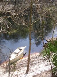
Enigma Resting at Key Largo
ManitouCruiser
Pulling in to the beach just a minute or two behind the XLXS team in their scary
tandem surf ski, we were fifth boat to finish the Everglades Challenge, and first
in of the Ultimate Challengers. I was pretty tired out after 3 nights with mostly
catnaps and only a couple hours' real sleep anchored at Checkpoint 2. Lazed around
talking with the other finishers under the trees at the wonderful old group camp
(which no longer exists, though the latest Florida land bust has kept it from being
paved over and planted with condos just yet). Had dinner with other finishers across
the street at a popular outdoor fish spot, then early to bed. After a good long
night's sleep found the wind had clocked around to northeast-- a headwind, with
little prospect for a good day's run, though forecast to go southeast next day--
so I decided to sit in and relax for the morning, and greet Manitou Cruiser and
Shark Chow who were predicted to finsh before lunchtime.
It was a beautiful pleasant day and comparing notes and route plans with my fellow
Ultimate Challengers was fun, but there were those who thought I ought to get myself
in gear and get back in the race. Certainly I could easily have left the Key Largo
checkpoint several hours earlier and made some useful time along the next leg, but
with wind and tide against us the gain wouldn't have been as much as all that, and
the chance to relax and socialize a little seemed worth more than a few slow miles
just then.
3/8/2006 Wednesday
By early afternoon the wind was beginning to veer further and I filled some water
jugs, stowed for sea and headed off up the Intracoastal Waterway (ICW) with good
wishes from the small croud of finishers and race managers.
|
Time
|
Landmark
Lat
|
Bears
Lon
|
Distance
|
Course
Wind
|
Speed
Sea
|
|
1315
|
Leave Key Largo finish
Proceeding NE up inside ICW
|
E 16 Kt
|
1'
|
|
1700
|
Jewfish Creek bridge- foul tide, scull
|
|
2115
|
25d 19.3'
|
80d 16.7'
|
|
E 12-14 Kt
|
1'
|
|
2115
|
Position report to Karen, course 135 @ 3 Kt
|
3/9/2006 Thursday
|
Time
|
Landmark
Lat
|
Bears
Lon
|
Distance
|
Course
Wind
|
Speed
Sea
|
|
0145
|
Come to anchor off SW
side of Sands Key. Sleep.
|
ESE 18 Kt
|
sm
|
|
0640
|
Up anchor and away.
|
SE 15 Kt
|
sm
|
Passed out to Hawk Channel through the narrow Sands Cut soon after first light.
Found a good sailing breeze, though the chop gradually increased as we sailed out
of the lee of the reefs and into deeper water.
|
Time
|
Landmark
Lat
|
Bears
Lon
|
Distance
|
Course
Wind
|
Speed
Sea
|
|
0750
|
Soldier Key
|
315
|
1.5nm
|
SE 20 Kt
|
1=3'
|
An hour or so later we crossed tracks with a large sportfisherman headed out towards
Fowey Rocks Light. The guy on the flybridge looked uncomfortable in the snappy cross
sea and gave me an interogative kind of wave as if to say what the hell do you think
you're doing out here when even us big boys have spray coming over? Gave him a cheery
thumbs up and continued on our way thinking no more of it. It's probably just be
a coincidence that shortly after that...
|
Time
|
Landmark
Lat
|
Bears
Lon
|
Distance
|
Course
Wind
|
Speed
Sea
|
|
0910
|
Approached by USCG #50, check
safety gear, exchange info,
referrred to CG Sector Miami,
set up coms every 60 min on half
hour until arrival
|
SE 18-20 Kt
|
4-5'
|
That's a pretty bare bones description of the encounter. The 35' Diesel patrol boat
came up from the direction of Key Biscayne and hung out off my quarter at some distance.
Seeing they weren't leaving I turned on my handheld VHF radio and held it up where
they could see, and shortly they came up on channel 16, small sailboat off Cape
Florida this is Coast Guard Miami Unit five-zero at your location, are you happy
Captain? over; and we went from there. What vessel, who aboard, citizen of, where
bound, (Sebastian, Florida-- set them back a few seconds), are you aware of weather
forecasts on your planned course (oh boy, here it comes)... Show us your life jacket,
done. Flares, done. whistle or sound producing device, done. Any other safety equipment
on board. EPIRB, safety harness, float cushion, upright flotation, self righting/self
rescuing. They didn't sound happy. What is your planned route. Outside to Lake Worth
or Fort Pierce Inlet, ICW to Sebastian; no, I wouldn't use Sebastian Inlet in these
conditions. Sounded unconvinced. Relayed latest weather forecast. Not frightened.
Recommend you consider going inside at Fort Lauderdale, stand by please.
I was reefed and luffing up slightly to slow down and let Enigma semi-heave-to,
sailing slow and easy with a peaky swell on our starboard quarter. It had been tolerably
rough crossing over the last of the reef into deep water a half hour earlier, but
was pretty comfortable and dry now, and I want to think Enigma must have looked
very seaworthy and under control to anyone used to small boats at sea. Without anyone
saying so I pretty much knew the skipper of #50 was in the unenviable position of
having to make a judgement call on whether to call my voyage off. The CG, with best
of intentions perhaps but with the mind of a beaurocracy, has taken on itself the
power to declare any voyage 'manifestly unsafe' in its own eyes and with no appeal
or recourse. They can and will tow your butt to shore and seriously fine it if you
start out again. So about all I could do was be cooperative, seamanlike and competent
looking, and hope the skipper was a seaman and could tell I was all good. The radio
went quiet for a long while and I knew he was on the horn to his boss, hoped I had
him on my side, but no way to know.
Finally they came back on and politely 'requested' that I contact CG Sector Miami
(the big boys with the high-site radio antennas that can hear you from the Bahamas)
and set up an hourly radio checkin sched, to be continued until I reached my destination
or safe harbor. Okay, done. It looked like it was that or be 'escorted' to Miami.
I got a friendly wave from the deckhand on #50 as they peeled off and started back
toward the Florida Channel throwing a wide white wake; I filled away and got back
on course at speed, surfing the occasional steeper, spilling breakers northward
|
Time
|
Landmark
Lat
|
Bears
Lon
|
Distance
|
Course
Wind
|
Speed
Sea
|
|
0946
|
CG #50 leaves, clear to continue
|
|
1035
|
Coms w/CG sec Miami all well
|
4.0 Kt
|
|
1045
|
Pos Rep Karen [Position Report
-was getting tired writing]
|
SW 20 Kt
|
4-6'
|
|
1135
|
Coms w/ Sec Miami all well
|
SE 16 Kt
|
4-7'
|
|
1240
|
Coms w/Sec Miami all well
|
SE 18 Kt
|
4-7'
|
|
1240
|
25d 57'
|
80d 04'
|
|
010
|
4.5 Kt
|
|
1335
|
Coms CG Sec Miami all well
|
|
1335
|
Pt Everglades "1" |345 |3.4nm |gps |SE 16 |4-5'
|
345
|
3.4nm
|
SE 16 Kt
|
4-5'
|
|
1430
|
Enter Port Everglades Breakwater
|
Concrete Canyons
I was getting sick and tired of the hourly radio schedule and its drain on my handheld's
batteries. Wimped out and ran inside to put an end to the hassle, but wish now that
I'd continued outside to Lake Worth Inlet, radio and all-- could have made it before
dark in the lovely fair wind. Instead spent the rest of the afternoon and evening
slowly working through the squirrely winds and swirling currents of the 'concrete
canyons' of one of the most populated and built-up stretches of waterway on the
east coast.
|
Time
|
Landmark
Lat
|
Bears
Lon
|
Distance
|
Course
Wind
|
Speed
Sea
|
|
1440
|
Coms Sec Miami, passed to
Station Ft lauderdale, all well,
proceed inside to Sebastian.
|
SE 14 Kt
|
sm
|
|
1510
|
Pos Rep Karen
|
|
|
|
|
|
1905
|
Pass Boca Raton bridges
|
SSE 16 Kt
|
sm
|
|
2205
|
Fl R "52" Boynton Beach
Pos Rep Karen, smooth sailing.
|
SE 15 Kt
|
sm
|
3/10/2006 Friday
|
Time
|
Landmark
Lat
|
Bears
Lon
|
Distance
|
Course
Wind
|
Speed
Sea
|
|
0130
|
Anchor behind Munyon Island,
N. end of Lake Worth
|
SE 22 Kt
|
sm
|
A nice secluded spot that got us out of the chop but little shelter from the wind.
Enigma tacked back and forth on the anchor all the rest of the night.
|
Time
|
Landmark
Lat
|
Bears
Lon
|
Distance
|
Course
Wind
|
Speed
Sea
|
|
0630
|
Away on ICW northbound
|
SSE 16 Kt
|
1'
|
|
0900
|
Jupiter Sound Bridge
|
S 15 Kt
|
sm
|
|
1220
|
St. Lucie Crossroads
|
SSE 22 Kt
|
1-2'
|
|
1225
|
Phone Karen, update ETA
|
010
|
5.0 Kt
|
|
1325
|
Jensen Beach Causeway- quick visit
from Karen, Ed Killer, download photos
|
An unnofficial stop to dump photos from my digital camera onto my wife's computer.
The local paper sent a sports reporter to do a short interview as well. Couldn't
stand to see the fair wind running to waste though, and was soon back on the road.
|
Time
|
Landmark
Lat
|
Bears
Lon
|
Distance
|
Course
Wind
|
Speed
Sea
|
|
1345
|
Resume ICW northbound
|
SSE 20 Kt
|
1-2'
|
|
1500
|
Power lines [St. Lucie Nuclear
Power Plant on Hutchinson I.]
|
SSE 20 Kt
|
1-2'
|
|
1630
|
Fort Pierce South Bridge
|
SSE 20 Kt
|
1-2'
|
|
1900
|
Vero Beach downtown bridge
|
SE 12 Kt
|
sm
|
|
2010
|
Coms w/ Chief re Check Pt-coordinate w/ Porky
|
|
2030
|
Pos Rep Karen
|
SSE 10 Kt
|
sm
|
|
2240
|
Arrive Sebastian CP ramp
|
SSE 8 Kt
|
sm
|
3/11/2006 Saturday
|
Time
|
Landmark
Lat
|
Bears
Lon
|
Distance
|
Course
Wind
|
Speed
Sea
|
|
0110
|
Porky arrives, check in
|
Porky kindly agreed to mind the Sebastian Checkpoint but I got there before he had
planned to. He gave up his evening to drive out with the CP lockbox and log so I
could sign in. I slept comfortably at the launch ramp dock till he got there, and
we had a nice talk while setting up the box and discussing logistics. Decided on
the inside route for next day or so to avoid the security exclusion zone around
Cape Canaveral, so we headed north up the ICW in Indian River, but didn't get far
that night...
|
Time
|
Landmark
Lat
|
Bears
Lon
|
Distance
|
Course
Wind
|
Speed
Sea
|
|
0120
|
Leave CP northbound
|
SW 6 Kt
|
sm
|
|
0600
|
Sebastian Inlet
Becalmed all night
in sight of inlet, sleep.
|
090
|
1.5nm
|
S 2-3Kn
|
sm
|
|
0600
|
Begin sailing now, patiently. Course 020, speed 1.5-2 Kt
|
|
0635
|
Ran over manatee in 2' water. Same very startled.
Most water in boat yet.
|
The manatee (or tees, I had the impression there were a pair but wasn't sure and
didn't log it so) was sleeping on the bottom in a depth where she could just arch
her back to reach up and breathe without waking up. As many small boaters around
here know, they don't like being woken up early, and tend to throw a lot of water
around in the process of swimming for deeper water. Some of which got in the boat
& my sleeping bag for the first time on the trip.
|
Time
|
Landmark
Lat
|
Bears
Lon
|
Distance
|
Course
Wind
|
Speed
Sea
|
|
0915
|
Grant Farm I
Pos Rep Karen
|
270
|
0.5nm
|
000
|
1.5 Kt
|
It had been calm for some time and I was sculling along at an easy pace in the quieter
eastern side of the Indian River. It looked like a long day, no point in getting
worn out early.
|
Time
|
Landmark
Lat
|
Bears
Lon
|
Distance
|
Course
Wind
|
Speed
Sea
|
|
1015
|
Wind! enough to sail...
|
SSE 5-6
|
3 Kt
|
|
1130
|
C. Malabar
Checked in w/ Chief,
sent luck to all in
Key Largo
|
315
|
2nm
|
SE 8-10
|
sm
|
|
1340
|
Eau Gallee Csy. Passed by tow
|
SE 12 Kt
|
1'
|
|
1715
|
Indianola Bridge
|
SE 16 Kt
|
1'
|
|
1830
|
Pos Rep Karen All well
|
|
1900
|
NASA Causeway
|
SE 8-10
|
sm
|
|
2045
|
Titusville Bridge
|
SE 8 Kt
|
1'
|
|
2215
|
2nd manatee collision of day (1st was at 0630 in Sebastian). Ran over close pair
(mating?) who promptly exploded, digging in head down with tails thrashing at surface
sending 2'-3' high sheets of water over/into boat.
|
This was a manatee behavior I hadn't seen before: They separated a few strokes in
different directions as would be expected, but then appeared to both go head-down
and dig their fins into the bottom to hold position, while furiously beating their
tales on the surface creating a really awesome splash and noise. Again had some
bailing to do. Makes me wonder if it may have been a family group and the adults
were covering the retreat of the kid(s)? I'm used to them just heading off at high
speed, splashing as they go for intimidating effect.
After getting my heart rate back down and clearing the bilge, we made the turn northeastward
above Merrit Island, and headed into rock-walled Haulover Canal.
|
Time
|
Landmark
Lat
|
Bears
Lon
|
Distance
|
Course
Wind
|
Speed
Sea
|
|
2320
|
Exit Haulover Canal
|
SE 6-8 Kt
|
sm
|
3/12/2006 Sunday
|
Time
|
Landmark
Lat
|
Bears
Lon
|
Distance
|
Course
Wind
|
Speed
Sea
|
|
0145
|
Anchor at spoil island, G '15' Mosquito Lagoon
|
S 5 Kt
|
Sm
|
|
0615
|
Under way sculling
|
calm
|
sm
|
|
0835
|
Pos Rep Karen All well, Light breeze comes up
|
|
1125
|
Coronado Beach Bridge
|
SE 12 Kt
|
sm
|
|
1155
|
Ponce De Leon Inlet
Cell phone out charging, took a wave, hope it survives.
|
SE 12
|
ESE
|
Weekend boat traffic out of Daytona Beach chased me off the ICW, and we took advantage
of a strong ebb to run out Ponce Inlet and head north in the Atlantic. Powerboat
wakes combined with confused groundswell in the inlet sent a wave over the deck
squirting water over my phone, which I should have stowed for sea earlier. Luckily
I got it dried off before any harm was done. As we angled out to a couple miles
offshore a moderate rolling swell along with frequent gannet sightings helped us
feel really at sea.
|
Time
|
Landmark
Lat
|
Bears
Lon
|
Distance
|
Course
Wind
|
Speed
Sea
|
|
1205
|
Pos Rep Karen - All well, no worry if no contact as phone is wet.
|
020
|
4.0 Kt
|
|
1600
|
29d 21.12'
|
81d 01.5
|
|
SE 15 Kt
|
3-4'
|
|
1600
|
Ormond By the Sea
|
240
|
2.5nm
|
000
|
4.5 Kt
|
|
1820
|
Overflown by Flagler Co. 'Firefly' helo, answered hail on VHF 16, 'No distress,
all well.' Helo so informed USCG Mayport. Helo continues search for sailboat in
distress S of me. I must say I have never been rescued so frequently in one trip
before.
|
Yes, that is the exact entry from the logbook, including the flippant comment. No
disrespect intended. The radio chatter was a little busier than logged but not much.
As before, when I noticed that the nearby chopper seemed to have an interest in
me & was coming uncomfortably close I turned on my VHF & held it up where they could
see. After a while with them racketing away over my shoulder & spoiling the nice
fair wind, I hailed them, helicopter three miles off Ormond beach, this is the small
sailboat at your location on one-six, can I help you, over? Think I had to repeat
the hail a time or two, but after a few minutes they came back and asked if I was
the sailing vessel in distress. No, not in distress, all well here. Had I seen any
other vessels in distress? No, had seen nothing unusual. They were polite, professional
and blessedly brief as befits a helicopter with limited fuel range. No fuss over
who I was, where bound, wanting to see safety gear. Said they would continue searching
the area south of me and headed off. As they started flying a grid a couple miles
behind, I heard them call up the local Coast Guard base at Mayport on 16 (they referred
to it as 'marine one-six' which may explain their delay in answering my hail: having
to deal with aircraft frequencies as well could be confusing). I followed the conversation
as they switched to 22A and listened as the helo crew gave a brief description of
the encounter and their plans. Sounded like it was the first USCG had heard of the
distress call and that they had no plans to join the search, which I found interesting.
I'd seen no other sailboats since going out Ponce inlet & thought most likely somebody
ashore, maybe in one of the tall condo buildings on the beach, had seen my unusual
rig in the distance and the low afternoon sun flashing off my windows and, thinking
I was some kind of lifeboat or something signalling for rescue, called 911. Guess
the chopper crew figured the same as they headed inland not long after. It's reassuring
that the county Fire-Rescue chopper was ready & willing to help, and found me promptly,
but scrambling a helicopter is a really big deal and NOT at all the kind of thing
I'd want to have happen on my account. Even in nice weather a chopper is distinctly
less safe than a good sailboat as well as horrendously expensive to run.
|
Time
|
Landmark
Lat
|
Bears
Lon
|
Distance
|
Course
Wind
|
Speed
Sea
|
|
1840
|
29d 32.6'
Pos rep Karen all well
|
81d 07'
|
|
000
|
4 Kt
|
|
2400
|
29d 52.6'
St Augustine
|
81d 09.5
|
S 8 Kt
350
|
2-3'
3.5 Kt
|
|
Wind calmed off overnight, but Enigma always managed to stay on course and moving
along with minimum attention, and I catnapped comfortably in a low, rolling swell.
3/13/2006 Monday
|
Time
|
Landmark
Lat
|
Bears
Lon
|
Distance
|
Course
Wind
|
Speed
Sea
|
|
0430
|
30d 03.0'
|
81d 14.3'
|
|
SW 3 Kt
|
SE 2'
|
|
0745
|
30d 08.2'
Pos rep Karen all well
|
81d 17.5'
|
|
SSW 5 Kt
000
|
SE 2-3'
2.5 Kt
|
A pleasant day, not fast progress but steady. Wind hauled on shore and built a bit
in afternoon but, as the dey before, it was just the local sea breeze filling in
along the coast, not a deep enough wind field to make up much of a sea.
|
Time
|
Landmark
Lat
|
Bears
Lon
|
Distance
|
Course
Wind
|
Speed
Sea
|
|
1230
|
St Johns R '4'
|
000
|
2.7nm
|
SE 8 Kt
|
E 2-3'
|
|
1320
|
St Johns R '4'
Sea steepens in river ebb current.
|
270
|
0.5nm
|
SE 8 Kt
|
E 2-4'
|
|
1448
|
N '6a" Nassau Sound
|
SE 12 Kt
|
E 2-3'
|
|
1600
|
30d 35.0'
|
81d 23.5'
|
|
SE 12-14 Kt
|
E 2-3'
|
|
1610
|
Call Chief, ETA Cp 1900
|
020
|
4.5 Kt
|
|
1740
|
St Marys Entrance, FL G '17'
|
S 14 Kt
|
3-4'
|
|
1820
|
Ft Clinch CP
Visited w/ Chief, exchanged [camera] chips
|
S 16 Kt
|
sm
|
Chief got some photos of Enigma coming in and leaving the Checkpoint, and swapped
my full camera memory chip for an empty one so as to upload my pix and video to
the website. I didn't stay long as tide and wind were fair for continuing to St.
Marys. and there was still a little evening light left.
|
Time
|
Landmark
Lat
|
Bears
Lon
|
Distance
|
Course
Wind
|
Speed
Sea
|
|
1840
|
Left CP bound up St Marys River
|
|
1910
|
Enter St Marys River
|
S 14 Kt
|
sm
|
|
2245
|
Anchor near high cut-bank halfway between [town of] St Marys & I95 bridge
|
S 6-8 Kt
|
sm
|
3/14/2006 Tuesday
|
Time
|
Landmark
Lat
|
Bears
Lon
|
Distance
|
Course
Wind
|
Speed
Sea
|
|
0500
|
Away under sail
|
SW 8 Kt
|
sm
|
|
0815
|
US17 Bridge Pos Rep Karen
|
SW 8-10 Kt
|
sm
|
|
1230
|
Flood [tide] ends. Rain squall.
|
W 20+ Kt
|
|
|
1305
|
Squall ends, swallows wind [begin sculling]
|
W 5-6
|
|
|
1330
|
Flea Hill
|
W 5-6 Kt
|
|
|
1430
|
Orange Bluff
|
Calm
|
|
|
1500
|
Rest, food, mast down
|
Calm
|
|
|
1730
|
Colerain. Bath time
|
NW light
|
|
Looked like cooler weather coming after the frontal passage and I took advantage
of the last of the warm evening to stop & have a sluice in the river. I'm a saltwater
guy, never waste fresh water.
|
Time
|
Landmark
Lat
|
Bears
Lon
|
Distance
|
Course
Wind
|
Speed
Sea
|
|
1915
|
Dinner stop
|
NW light
|
|
We'd been pushing upstream against the ebb tide all afternoon. By stopping for a
couple hours to eat and rest, I let the advancing crest of the next flood tide catch
up with me, and when I started sculling again had half a knot or so of upstream
current helping me along, which we were able to carry all the way to Traders Hill.
|
Time
|
Landmark
Lat
|
Bears
Lon
|
Distance
|
Course
Wind
|
Speed
Sea
|
|
2210
|
Pos rep Karen poor coms
|
180
|
2.5 Kt
|
|
2250
|
US1 Bridge
|
NW light
|
|
Spooky area on a dark night, the tall road and rail bridges cutting high through
the trees to the distant bluffs, while the river winds in oxbows through slough
and swamp below. Was hard to keep oriented and I relied on the compass for my sanity.
3/15/2006 Wednesday
|
Time
|
Landmark
Lat
|
Bears
Lon
|
Distance
|
Course
Wind
|
Speed
Sea
|
|
0105
|
Traders Hill. Cool night.
|
Calm
|
|
|
0745
|
Pos rep Chief, Pos rep Karen, leave phone charging at campground while doing chores.
Dump ballast, re-stow, clean up
|
Slept in and woke to frost on deck. Traders Hill campground was empty at mid-week
but looked nice. Up the steep hill the camp sites had electric and water that I
took advantage of. Walked out the access road a ways to stretch my legs but returned
soon to discharge our sand sailing ballast in the dirt road and clean up the boat,
while waiting for phone to charge.
|
Time
|
Landmark
Lat
|
Bears
Lon
|
Distance
|
Course
Wind
|
Speed
Sea
|
|
0910
|
Under way, moderate current
|
NE 10
|
|
|
1115
|
Snack break on sandbar. River shoaling, current still easy
|
NE 10-12 Kt
|
|
|
1320
|
Snack break
|
? 10-12 Kt
|
|
|
1510
|
Snack/nav break- current stronger, trees in road
|
Calm
|
|
|
1710
|
Snack/nav. Easier going.
|
Calm
|
|
|
1935
|
30d 37.4
|
82d 02.2
|
|
Calm
|
|
|
1935
|
Dinner stop near Toledo
|
Tied to an overhanging tree near a steep hill. After a cooked dinner hiked up for
some antenna altitude and made a scratchy shouted phone call to Karen. Not logged
but as I recall we continued sculling upriver for another couple hours after that
before stopping for a long night's sleep.
3/16/2006 Thursday
|
Time
|
Landmark
Lat
|
Bears
Lon
|
Distance
|
Course
Wind
|
Speed
Sea
|
|
0630
|
Under way. Cold, foggy, pretty.
|
Calm
|
|
|
0845
|
Food & chart break. Short fast pitches through tree & drift bars, alternating with
slower reaches. Pretty country.
|
River was mostly wild and mostly empty. Very occasionally we'd come across fishermen,
all done up in camoflage gear, in nicely fitted-out high-powered camo-colored jonboats.
Georgians mostly, seemed friendly and talkative but I didn't wait long to talk.
In several places there were long looping oxbows of dead water where the river had
cut a new straight chute of fast water across a neck of the low bottomland. Following
the mapped channel could get one in trouble as the upper ends of some of these oxbows
were closed off by sandbars at this (moderate) river stage. Had to stay in the fast
current of the chutes. As we continued upstream there were more and more deadfalls
and sweepers, some taller trees extending clear across the river and trapping walls
of driftwood and brush, where a narrow opening would be cut through just wide enough
to pass the local jonboats. At one place I was crowded right up to one sandy bank
to get around the top branches of a fallen tree still rooted in the opposite bank.
Taking a moment off from poling, I hopped ashore and scratched WIZARD in 2 foot
letters in the smooth sand, hoping it would still be there when the next Triber
came through in a day or two (it was- Shark Chow saw it as he squeezed through the
same narrow space).
|
Time
|
Landmark
Lat
|
Bears
Lon
|
Distance
|
Course
Wind
|
Speed
Sea
|
|
1125
|
Break. Easy current mostly
|
SE? light
|
|
|
1300
|
Food break. Pos rep Chief
|
S light
|
|
|
1415
|
Arrive St George CP. Greeted by Chief. Relax for 10 min. then up the ramp.
|
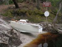
On The Road
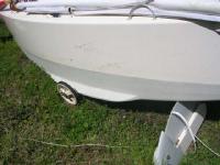
Took a few minutes more to prepare for the road portage. Enigma's portage rig is
the same as on several other of my small boats, a pair of 12" pneumatic wheels scavenged
from a junked kids' scooter. These are the same as the smallest size of kids' bicycle
wheels, and tires, tubes and bearing parts are widely avalable to fit them anywhere
you go. I rebuilt these wheels with long axles extending out on one side, that socket
into tubes inset in the chines of the boat amidships, so you only need to lift up
one side of the boat at a time and slide the axle in place. The wheels are cambered
under a little so gravity holds the wheel in place, and it's a quick process with
no tools.
Also lashed the sculling oar to the foredeck extending out over the bow several
feet, to form a tow bar at convenient hand height.
|
Time
|
Landmark
Lat
|
Bears
Lon
|
Distance
|
Course
Wind
|
Speed
Sea
|
|
1525
|
On the road. Good pavement & a 2' hard shoulder, good so far!
|
|
1830
|
Visit on road from Chief, rigged for dark, onward.
|
W 10 Kt
|
|
"Rigging for dark" consisted of setting out some food and water where it was handy,
checking flashlight, and hanging reflectorized orange life vests and bicycle flashers
fore and aft for visibility to passing traffic. Ten minutes later we were rolling
again, and the cooling temps made for faster and even more pleasant progress. Traffic
after dark was very light, several minutes to half an hour between one car and the
next, no trucks.
|
Time
|
Landmark
Lat
|
Bears
Lon
|
Distance
|
Course
Wind
|
Speed
Sea
|
|
1950
|
Cross St Marys River bridge at Moniac. Deep steep gulch w/ high bridge at level
of surrounding plain.
|
Left the boat briefly and jogged down a side road to a nice little riverside park
and launch ramp under the bridge. River looked still wide and deep enough to be
paddleable as far as I could tell in the dark. Just looking, for future reference.
|
Time
|
Landmark
Lat
|
Bears
Lon
|
Distance
|
Course
Wind
|
Speed
Sea
|
|
2030
|
Stop for night (hope...) at Forrest Svc. dirt road on S side 3 miles past St Marys
bridge. Quiet!
|
3/17/2006 Friday
|
Time
|
Landmark
Lat
|
Bears
Lon
|
Distance
|
Course
Wind
|
Speed
Sea
|
|
0630
|
Back on the road
|
Calm
|
|
|
0755
|
Breakdown, or nearly. Left wheel sidewall failing. Stop to repair. Patch tube (staple),
wrap tire with poly mesh from lee cloth, overwrap all w/ 1/4" nylon rope, looks
crazy, hope works...
|
First Repair
Found the problem during a routine short food break; the port wheel was very low,
rim nearly on the ground. Pulled out onto the apron of a side track and chocked
the boat up to remove the wheel, set to patching tube. Trouble was from a small
bit of wire, maybe a staple, picked up in the tire; it had just nicked the tube
and the slow leak had gradually been letting the tire sidewalls flex more and more
as we rolled. Over who knows how many miles of this mistreatment the tire, an old
one with several hundred miles already on it, had broken down to the point where
rubber was sloughing off the sides in sheets and the nylon belting was badly chafed
and starting to tear.
I had all kinds of repair and replacement parts for the portage wheels: patch kit,
pump, spare tube, a complete spare axle with bearings and nuts, but no spare tire.
How many cyclists carry a spare tire for a 40 mile trip? Difference is on a bike
you'd notice the low tire before it had time to do itself much harm, which I should
have made sure of by more frequent wheel checks.
Anyhow after thinking on my options and materials on hand, I tried to repair the
tire, attempting to rejoin the still-serviceable tread to the bead by sacrificing
a heavy trampoline-mesh lee cloth and wrapping a section of the fabric around the
inside of the tire between tire and tube. Once reassembled and pumped up this didn't
look like a big improvement, there wasn't enough of the original belting left to
contain the mesh, and the tube was bubbling out through big gaps in the sidewalls.
Grabbed some spare nylon line and started spiral wrapping over the tire and through
the spokes around the inside of the rim, a long process but finally done. The tire
now looked pretty crazy but was holding together, and we hit the road hoping for
the best.
|
Time
|
Landmark
Lat
|
Bears
Lon
|
Distance
|
Course
Wind
|
Speed
Sea
|
|
0905
|
Back on road
|
|
|
|
1020
|
Interview by Roger Bull, Jax Times- ?
|
Stopped a while in a shady spot while a Jacksonville newspaper reporter Chief had
gotten in touch with took my impressions of the trip. He said he was headed back
to St. George to try and talk to Manitou Cruiser, who he'd heard was getting ready
to hit the road there. Would try to catch up with me again later.
|
Time
|
Landmark
Lat
|
Bears
Lon
|
Distance
|
Course
Wind
|
Speed
Sea
|
|
1050
|
Visit from Chief, pix by Chris, Jax paper
|
|
1115
|
Left tire wears thru, flat.
|
After only 7 miles or so the rope wrapping wore through and parted, and the tube
popped out the unsupported sidewall exploding. Back to the soft shoulder. I'd been
picking likely looking strips of dead tires from the roadside as we went, thinking
about what do do next if the first fix didn't last out. After replacing the split
innertube I cut some pieces of thin sidewall rubber and worked them into the worst
parts of the tire, and wrapped the whole mess back up in the now-very-frayed nylon
line which I tied up and tightened the best I could. And we rolled on.
|
Time
|
Landmark
Lat
|
Bears
Lon
|
Distance
|
Course
Wind
|
Speed
Sea
|
|
1230
|
On the road, wrapped line over some strips of road-kill tire belt
|
|
1420
|
flat again. Roger reporter and Chief show up while repairing. Chief donates hose
clamps & loans screwdriver. Made new hard tire from strip of road-kill truck tread.
|
Saving the remains of the bad tire wasn't working out so I took the next step of
trying to build a new, solid tire. Stripped off everything down to the bare plastic
rim and wound in a strip of heavy steel-belted truck tire tread that had caught
my eye lying in the weeds a few miles back. It was just the right width to jam tightly
into the channel of the rim. I needed to secure the ends of the rubber strip and
Chief, who had stopped by in his rounds of overseeing the various checkpoints, suggested
some stainless steel hose clamps he had as spares for his truck. That looked like
working and after some fighting and cussing with the reluctant rubber I got things
together well enough to give it a try.
|
Time
|
Landmark
Lat
|
Bears
Lon
|
Distance
|
Course
Wind
|
Speed
Sea
|
|
1515
|
On the road. Frequent stops to trim & adjust tire. This might work!
|
Last Repair
Not individually logged are all the breaks needed to keep the new tire happy- first
to shorten the rubber strip which stretched out gradually under the constant rolling.
Then adjusting the clamps as they flexed and loosened. Then after a few miles first
one and then the other hose clamp fatigued and fell off. I stopped to see what could
be done but couldn't think of anything useful. Trying to screw or wire the rubber
in place seemed doomed to fail faster than the hose clamps. Lashings had already
shown to chafe faster than you could apply them.
But the rubber strip seemed willing to stay more or less in place on its own. Through
good luck and no planning on my part the strip came to me slightly wider at one
end than the other, and I'd fortuitously installed it the right way around so the
fat end, jammed tightly between the sides of the rim, hit the road first, and the
thinner tail rolled out behind it, often flapping loose as it passed over the top
of the wheel but always rolling back into the groove as the wheel advanced over
it. It was scary but fun to watch, I'd turn around and walk backwards for a few
hundred steps just marveling as the makeshift tire unwound and rewound itself 90
times a minute. There was some pretty heavy bumping as the thick head of the tire
hit the road every revolution, and a sympathetic vibration of the whole boat at
a frequency 3 times the wheel period right at my comfortable walking speed- it lessened
if I sped up or slowed down but I gave up trying to smooth the ride and just went
my pace, letting the boat bang along at its own peril.
When you're walking along a lightly-travelled country road for hours on a hot afternoon,
you have plenty of time to think about your options. All the obvious ones went through
my head. If this last-ditch tire failed, or if the plastic rim folded under the
constant vibration, I could call Karen and she could be here by dark... We could
load Enigma on the car and get out of here, never more this long, long, straight
road disappearing over the horizon ahead, no more logging trucks whizzing past your
elbow, nor sculling along strange spooky rivers in the dark... Or I could push the
boat into a clump of bushes and try to bum a ride to somewhere with a Wal-Mart or
a bicycle shop to buy a new tire- Lakeland or Valdosta looked like the best chances,
farther than I'd want to walk. Would the boat survive a day without me? Occasionally
a passing vehicle would slow and roll beside us for a while, whatthehell you doin'
boy, need help, like that. One of the log truckers, who had certainly passed us
a couple times already going back and forth to the mill, idled his empty rig for
a couple minutes getting the story, and offered to come back with his pickup after
his shift was over, get us to Fargo or White Springs or wherever we wanted. Nice
guy. No thanks, enjoying the walk, you have a great day now.
And the tire kept rolling, and I kept walking.
|
Time
|
Landmark
Lat
|
Bears
Lon
|
Distance
|
Course
Wind
|
Speed
Sea
|
|
1800
|
Edith. Only 1 mile to go! Tire is holding but bumping & vibrating badly.
|
|
1840
|
Fargo ramp. Made it! Clean up & put in. Dinner w/ Chief. ManitouCruiser delayed
by slow bike, won't arrive till tomorrow, pity. Sleep!
|
|
|
3/18/2006 Saturday
|
Time
|
Landmark
Lat
|
Bears
Lon
|
Distance
|
Course
Wind
|
Speed
Sea
|
|
0630
|
Pos rep & conversation w/ Karen on pay phone at gas sta. Fill water. (Still at Fargo)
|
|
0710
|
Under way on Suwannee R. Pretty!
|
|
1110
|
FL line
|
E-SE 10 Kt
|
|
|
1330
|
Launch ramp park. Right wrist hurts, slow going. Up mast & sail, try to rest.
|
I was starting to feel the results of a minor injury coming up the St. Mary's River
a couple days before. We'd been poling up the inside of a bend, pushing fairly hard
into a moderate current, when a plant of the pole had gotten stuck in a tree root
or something on the bottom, and I wrenched my right wrist before getting it loose.
Thought nothing of it and pushed on, but the repetitive stress of all that sculling
and poling had worked on the joint and interfered with healing, and I was starting
to pay for it.
Tea Kettle Tree
Mostly the river was deep and slow with heavy forest overhanging the banks. Big
ancient teakettle-shaped trees grew out in mid-stream and and formed the banks in
some sections, other times the river cut through steep hills or rock ledges. At
one point a rustling noise from around the next bend announced a riffle of fast
water and I landed on the right bank and walked ahead to scout. Bank became steeper
till I was clinging by finger- and toenails to a narrow game trail and climbing
over trees growing horizontally out of the rocky cut-bank. Good news was what I
could see of the river looked easy class 1, but I gave up climbing before I got
to the end of the riffle. Went back and ran the gentle rapid mid-river without incident,
about 2' water with rocky uneven bottom and a few boulders.
|
Time
|
Landmark
Lat
|
Bears
Lon
|
Distance
|
Course
Wind
|
Speed
Sea
|
|
1600
|
Rt. 6 Bridge
|
Light Var.
|
|
|
2130
|
Deep Creek Anchor
|
|
|
Bow anchor out in the mouth of aptly named Deep Creek, just above Big Shoals; a
stern line to a fallen tree ashore for redundancy- didn't want her to break loose
and drift down river just here... Would have gone on a couple more hours but didn't
care to deal with Big Shoals in the dark. Made dinner and conked out with the cabin
light on, listening to the radio. Some time later waked suddenly with the feeling
there had been a noise, must have been the radio? Turned everything off and back
to sound sleep.
3/19/2006 Sunday
|
Time
|
Landmark
Lat
|
Bears
Lon
|
Distance
|
Course
Wind
|
Speed
Sea
|
|
0620
|
Under way
|
Calm
|
|
|
0730
|
Big Shoals top trail- scout rapids, find Mark (M.C.) at bottom put-in. Nice talk,
catch up on travels. Pix of him leaving.Carry gear down trail, fix wheel again,,
move boat.
|
Big Shoals Top
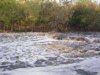
Big Shoals 1st Drop
Big Shoals River Left
Big Shoals Bottom
As we pulled in to the well-marked upper end of the portage trail at Big Shoals
the first thing I saw was a big MANITOU WAS HERE scratched in the sand of the take-out.
Had had a feeling he'd catch us yesterday and been looking over my shoulder all
afternoon. Hurried off down the riverbank to scout, hoping he was still around somewhere.
The falls looked just too much to run comfortably, looked like the abrupt limestone
ledges would catch Enigma's rudder a good hard whack at each of the two main drops;
losing headway and getting caught in the backwash would be no fun. Might be able
to manhandle and line her over in shallow slower water river left, but there were
a lot of branches and junk in the water and along the banks, looked hazardous. Portage
trail looked like best option.
Scouting the bottom put-in of the trail I found Manitou Cruiser's overnight bivouac
just as he was breaking down and packing up. He was in great spirits, enjoying his
trip. He'd seen Enigma at anchor as he passed last night, had I heard him paddling
quietly by in my sleep? Maybe not. Kind soul that he is, he offered repeatedly to
help me move Enigma around the portage, she looks a heavy unwieldy thing to people
who don't know her well. But I sent him on his way with a warning not to slack off,
I'd be trying hard to catch up.
Little Shoals
Carried a couple loads of gear and supplies down to the low end, then skidded Enigma
up the nice even slope of the portage take-out and got her back on the wheels (temporarily
lashing that rubber strip tire back into the bad one). The lower put-in is rougher
with uneven steep rock and mud obstructed by small trees and brush, but with a couple
guide ropes I got her slid back down without incident and reloaded in a little back-eddy
covered in foam from the falls. Just as a troop of canoeists came down (half ran
the rapids and got wet, half carried) we set off down toward Little Shoals, which
was no trouble, choppy but mostly deep enough to scull through at that water level.
|
Time
|
Landmark
Lat
|
Bears
Lon
|
Distance
|
Course
Wind
|
Speed
Sea
|
|
0940
|
under way below big shoals.
|
Calm
|
|
|
1120
|
Rt 41 Bridge. Wrist hurts.
|
Light
|
|
|
1130
|
Pos rep Karen from top of bank
|
|
|
|
1150
|
Rt 135 Bridge [White Springs] Pos rep Chief
|
|
|
|
1220
|
Begin sailing - slow!
|
Lt Var
|
|
|
1335
|
Shark Chow passes by. Good spirits, moving fast.
|
Back in deep slow water below the Shoals. Banks are high with tall trees right to
the water's edge, only reason to sail was to spare the bad wrist. Shark Chow looked
like he had a motor going as he swept past with a spreading wake behind, under a
shady straw hat. We talked for a minute but neither of us thought to take photos.
|
Time
|
Landmark
Lat
|
Bears
Lon
|
Distance
|
Course
Wind
|
Speed
Sea
|
|
1450
|
Rt 75 bridge sailing
|
E 5-10 Kt
|
|
|
1900
|
Suwannee Springs, US 129 bridge [sculling]
|
Calm
|
|
|
2130
|
resume sailing
|
E 5-10 Kt
|
|
3/20/2006 Monday
|
Time
|
Landmark
Lat
|
Bears
Lon
|
Distance
|
Course
Wind
|
Speed
Sea
|
|
0220
|
Rt 751 Bridge
|
|
|
|
0250
|
Stop 2 mi past bridge. Tied to bank, ate some cold food, rolled over & slept hard
for a few hours.
|
|
0645
|
Under way. Sailing. Wrist inflamed, swolen, ow. Better current, 1.5 kt.
|
|
0930
|
Suwannee R. St Park. Pos rep Chief. Pos rep Karen. Fill water.
|
|
1000
|
US90 Bridge. Begin sailing
|
E 5-10 Kt
|
|
|
1120
|
Stop to pick up ~90lbs sand ballast. Resume sailing in building winds
|
S 15-18 Kt
|
sm-1'
|
Beating down the widening river against the stiff headwind was faster than trying
to scull. Deep enough to tack bank-to-bank taking advantage of the lifts approaching
each steep shore.
|
Time
|
Landmark
Lat
|
Bears
Lon
|
Distance
|
Course
Wind
|
Speed
Sea
|
|
1510
|
Rt 250 Bridge. Dowling Park
|
SW 20-22 Kt
|
sm
|
|
1525
|
Tree falls in woods. I heard it.
|
|
|
|
1830
|
Blue Spring St. Park.
|
SW 10 Kt
|
sm
|
|
2025
|
Rt 51 Bridge. Pretty suspension
|
? 5 Kt
|
sm
|
Just below the bridge came that familiar rustling sound out of the black dark ahead.
There was just enough light to see the silhouette of the skyline overhead on both
sides and a less-dark gray path of river ahead, no way to read the water but it
didn't sound bad. I tried my best to dope out a route through the gentle rapids
by ear. River left seemed to work pretty well, a lot louder to the right and we
only bumped bottom occasionally with the sculling oar except for a hundred yards
or so of shallower rocky bottom.
Overhanging Tree
As we came out the bottom of the riffle a patch of trees standing in the water suddenly
appeared out of the dark. Before I could turn an overhanging branch reached out
and grabbed Enigma's mast, bringing her to a stop in the still-fast current. As
she started to swing out of control the branch slid across the mast; just as we
were about to slip free it caught a loop of main halyard. With the river pulling
her downstream and the tree pulling upstream from the masthead, Enigma swung broadside
to the current and came to equilibrium at about 40 degrees of heel with foamy water
lapping the upstream deck.
No immediate danger but stuck fast until I do something; thought about options for
a few seconds. Fortunately the easy solution worked, I turned out the stopper knot
from the inboard end of the halyard and Zip! off it ran out of the cockpit and up
the mast, by good luck not fouling in the sheaves or whipping a turn around something,
and we popped upright and drifted free. And pressed on...
3/21/2006 Tuesday
|
Time
|
Landmark
Lat
|
Bears
Lon
|
Distance
|
Course
Wind
|
Speed
Sea
|
|
0330
|
1.5 mi above Branford Tie to snag for sleep.
|
SW 10-12 Kt
|
sm
|
|
0630
|
On the road
|
SW 10 Kt
|
sm
|
|
0710
|
Branford boat ramp Pos rep Karen
|
SW 15-18 Kt
|
|
|
1110
|
Wannamake. Light rain, thunder
|
SW 18-20 Kt
|
|
|
1330
|
Rt 340 Bridge. Dry, mixed cloud
|
SW 20+ Kt
|
|
|
1540
|
Wannee
|
SW 18-20 Kt
|
|
|
1910
|
Pos rep Chief
|
SW 6-8 Kt
|
|
|
2050
|
Fanning Springs Rt 98 Bridge
|
SW 4-6 Kt
|
|
3/22/2006 Wednesday
|
Time
|
Landmark
Lat
|
Bears
Lon
|
Distance
|
Course
Wind
|
Speed
Sea
|
|
0320
|
Fowlers Bluff. Sail/nap/scull
|
W 4-6 Kt
|
|
Suwannee Bank
Suwannee Sailing
East Pass Horizon
It was a long last night on the river. I wanted to catch the ebb tide down the last
reaches and out to the Gulf so pressed on. Was really tired and sleepy. While sailing
I'd try to set her on a course where she could fetch along untended for a few minutes
and catch a short nap; sometimes I'd wake myself up before she crashed into the
bank, sometimes not.
Sculling down past Manatee Springs park I started having the persistent delusion,
maybe not quite a hallucination, that the right bank (which I was facing, standing
cross-wise in the cockpit to scull off the stern) wasn't solid continental land
but a group of small narrow islands with open water behind. Occasional groups of
lights on a house or dock just reinforced the illusion in the black night, locating
the 'islands' and emphasizing the 'passes' between. Had to constantly resist the
temptation to head out between a pair of 'islands' into open sea, get off this interminable,
narrow, restricting river. Was awake enough to know the perception was wrong, but
not enough to turn it off and see the world as it was.
With the lightening gray of dawn the illusion disappeared and we were back in the
river, sailing where a wind came down broad reaches between high trees,, sculling
through the calm bends and narrows, with a growing ebb added to the river current
helping us on.
|
Time
|
Landmark
Lat
|
Bears
Lon
|
Distance
|
Course
Wind
|
Speed
Sea
|
|
0740
|
Exit East Pass to Gulf. Horizon a welcome sight after 4 days on river.
|
N 5-8 Kt
|
|
|
0940
|
Rattlesnake Key
|
NE 10-12 Kt
|
1'
|
|
1045
|
Cedar Key CP. Salty Frog suggests tie to fishing skiff in main channel as no water
at CP beach. Visit w/ SF. Pos rep Karen. Call Jack & Millie, short visit at their
home. Charge cell phone.
|
Cedar Key
Salty Frog and the Checkpoint log said that Shark Chow and Manitou Cruiser had checked
out of the CP early that morning. The forecast was good for all of us but less favorable
next day and while I could have used a couple hours sleep I was eager to get moving.
Finally pulled the plug on my cell charger and headed out just after noon.
|
Time
|
Landmark
Lat
|
Bears
Lon
|
Distance
|
Course
Wind
|
Speed
Sea
|
|
1220
|
Depart CP for last leg.
|
SW 10 Kt
|
1'
|
|
1600
|
29d 00.2
|
80d 50.2
|
|
WNW 16 Kt
|
2-3'
|
|
1600
|
Finish (Just checking the distance to go...)
|
83.3nm
|
170
|
|
That afternoon was one of the most pleasant sails of the trip, fair wind strong
enough to move well but not raise much sea, steady enough for the boat to self-steer,
sunny and warm. Napped on the open water crossing to Crystal River power plant,
cut through the outer end of the plant's barge canal which extends a long line of
spoil banks miles out into the shallow Gulf. Crossed the spoil bank in a splash
of breakers and onward in 3-4' water toward the islands of the Chassahowitska NWR.
|
Time
|
Landmark
Lat
|
Bears
Lon
|
Distance
|
Course
Wind
|
Speed
Sea
|
|
1845
|
St Martins Key
|
090
|
1.5nm
|
NNW 12 Kt
|
1'
|
|
2000
|
Anclote Key FL R '4'
|
170
|
25nm
|
NNW 15 Kt
|
1-3'
|
A bunch of commercial fishing trawlers ahead and offshore of us kept me alert for
several hours after dark, managed to stay clear of them without too much trouble.
Once they were all over the horizon astern we were alone on the water and I could
let the boat self-steer for hours at a time, though much of the time she was going
at reduced speed to let me relax and catnap.
3/23/2006 Thursday
|
Time
|
Landmark
Lat
|
Bears
Lon
|
Distance
|
Course
Wind
|
Speed
Sea
|
|
0100
|
Anclote Key FL R '4'
|
160
|
16.5nm
|
NE 20 Kt
|
2'
|
|
0400
|
Anclote Key FL R '4'
|
170
|
5.5nm
|
E 20 Kt
|
2+'
|
|
0530
|
Anclote Key FL R '4'
|
090
|
1nm
|
E 20 Kt
|
1-2'
|
|
0710
|
FL G '1' Channel
|
090
|
.25nm
|
ENE 18 Kt
|
1+'
|
|
0755
|
Posrep Karen
|
|
|
ENE 12 Kt
|
1'
|
Karen gave me the latest news of the leaders. I was still behind Shark Chow and
Manitou but seemed to be closing. I told her 'It's still a horse race,' and that
it would all depend on exactly when the forecast wind change come later that morning.
I had the choice of heading inside to the ICW to hedge against the wind shift and
set up for better flat water rowing, or staying out in the gulf where sailing was
faster while the wind held. Decided gambling on a later wind shift and staying out
was our only hope of catching the leaders, and carried on.
|
Time
|
Landmark
Lat
|
Bears
Lon
|
Distance
|
Course
Wind
|
Speed
Sea
|
|
0945
|
Clearwater Pass Fl G '1'
|
ENE 14 Kt
|
1'
|
|
1230
|
Redington Pier
Beating up slowly
|
175
|
1.2nm
|
ESE 10 Kt
|
1+'
|
That was it, the wind had veered south of east just as my course came east of south
rounding the bend of Indian Rocks Beach and Redington Shores. There was no way I
could catch the faster paddling boats now. To top it off over the next hour the
headwind gradually faded away, leaving us bobbing in a leftover chop of sea with
barely steerageway.
|
Time
|
Landmark
Lat
|
Bears
Lon
|
Distance
|
Course
Wind
|
Speed
Sea
|
|
1345
|
Johns Pass
|
315
|
2nm
|
CALM
|
>1'
|
|
1425
|
Sculling, light W fills in
|
W 2-4 Kt
|
sm
|
|
1730
|
Pass A Grille; Flukey come & go wind always ahead... Pos rep Chief
|
045
|
1.5nm
|
SE 3-5 Kt
|
1'
|
It was most frustrating. the wind would come up from one direction, blow long enough
to get a little chop going, then die off to calm again, and repeat from a new direction.
Sea was small but confused and bobbly enough to keep our progress painfully slow
whether sailing, motorsailing with the paddle, or sculling with sail down, all of
which I did by turns all afternoon still nursing my wrist. Finally after crossing
the long bay off St. Pete Beach a couple miles off shore, we came in with the beach
at the northern point of Mullet Key, and, trying to stay out of the ebb tide pouring
out of Tampa Bay, started poling along in about 3' water. The last few miles were
among the slowest of the trip between foul wind and current, the continuing chop
and groundswell off the Gulf, and just sheer exhaustion. Sailed out around the end
of the outer fishing pier and in again right under the guns of Fort DeSoto, and
hit the beach with the last of the evening breeze at the foot of the inner pier.
|
Time
|
Landmark
Lat
|
Bears
Lon
|
Distance
|
Course
Wind
|
Speed
Sea
|
|
1900
|
Poling up W side Mullet Key
|
SE 5-6 Kt
|
sm
|
|
1955
|
Ashore at Finish, haul out, search for lock box. Hailed by Chief & SandDollar, Dinner
out, Pos rep Karen.
|
Finishing was blessedly anticlimactic; low-key congratulations from Chief and SandDollar
who'd come down to meet SharkChow, the winner, ManitouCruiser, a close second, and
had been hanging around waiting for me as my ETA moved back and back through the
day. They took me out for a nice Italian dinner, handed over the official awards
(shark-tooth necklace and inscribed paddle) and dropped me off back at the park
where I found a pay phone and called Karen for a nice long chat. Then I shoved Enigma
back out and anchored a short distance off the inside pier where we shouldn't get
run over by passing traffic, and slept till well past sunup.
|
Time
|
Landmark
Lat
|
Bears
Lon
|
Distance
|
Course
Wind
|
Speed
Sea
|
|
2133
|
Anchor off Bay Pier, nr. Finish
So ends Ultimate Florida Challenge.
|
Calm
|
|
Post Script
The Ultimate Florida Challenge was the longest sailing trip (or vacation of any
kind) I'd had in over a decade, and WELL worth the outlay in money and time in many
ways. Showing that a sailboat could do the cross-Florida leg (formerly WaterTribe
Okefenokee Challenge, and only attempted by canoes and kayaks) was one fun part.
I thought it was interesting that boats from Class 1, 3 and 4 all finished within
a few hours of each other after 20 days on the water.
Enigma worked really well for most phases of the race, obviously she was least competitive
on the river sections, held back further by my slight injury. She was surprisingly
non-slow on the long road portage- if not for the wheel trouble her portage time
would have been among the better of the eight boats that did it. Her best performance
though was where there was enough wind and open water to set her up and let her
go, when the low-stress, reliable, take-care-of-her-crew nature of this enclosed-cockpit,
self righting cruiser lets her keep covering miles in comfort while most of the
competition is exhausted, uncomfortable and looking for a campsite.
3/24/2006 Friday
A New Voyage Begins
|
Time
|
Landmark
Lat
|
Bears
Lon
|
Distance
|
Course
Wind
|
Speed
Sea
|
|
0800
|
Sleep late. Pos rep Karen, fill water.
|
Having finished the UFC well inside the 30-day time limit, I still had the rest
of the month free and discussed with Karen using it to sail home. She was fine with
that, the cross-state round trip by car is no fun for either of us. There were no
other finishers due in for a few days and I didn't think they'd fault me for not
waiting to see their triumphal return, so I checked supplies (plenty left), filled
a few water jugs from the beachside restroom sink and headed off again mid-morning.
I began a new voyage in the log:
|
Time
|
Landmark
Lat
|
Bears
Lon
|
Distance
|
Course
Wind
|
Speed
Sea
|
|
1000
|
From Mullet Key, St Petersburg, towards Jensen Beach, FL; Away from Bay Pier beach
|
NW 25
|
1=3'
|
|
1720
|
Venice Inlet (inside)
|
NW 25 Kt
|
|
|
1950
|
Lemon Bay G '41' Stop for night
|
NW 20 Kt
|
|
A cold front had moved through the previous night making the Gulf and passes rougher
than I needed to deal with, so we sailed inside all day on the Intracoastal route.
Chilly from a day in the cool wind, we pulled into a tiny private canal between
rich folks' houses on the Island side of Lemon Bay, behind good dense tree cover,
to get out of the wind for dinner. Slept deep.
3/25/2006 Saturday
|
Time
|
Landmark
Lat
|
Bears
Lon
|
Distance
|
Course
Wind
|
Speed
Sea
|
|
0610
|
Under way
|
N 8-10 Kt
|
sm
|
|
1010
|
Gasparilla I. Bridge
|
N 15-18 Kt
|
sm
|
|
1910
|
Fort Myers Bridges
|
NNW 20 Kt
|
1-2'
|
|
2015
|
St Mi 131 Okeechobee Wwy. Stop for nightin lee of N bank. Quiet.
|
NW 8-10 Kt
|
sm
|
Made good time running down the coastal bays in cool northwesterlies. Now things
got slower working along the narrow Okeechobee Waterway canals against the veering
wind. Fortunately the ailing wrist had had a couple days to recover, and with the
race over I could afford to go slow and easy. It continued to warn me if I pushed
too hard but was on the mend.
3/26/2006 Sunday
|
Time
|
Landmark
Lat
|
Bears
Lon
|
Distance
|
Course
Wind
|
Speed
Sea
|
|
0640
|
Underway sculling, poling. Clear, cool, light adv.fog
|
N 5-6 Kt
|
sm
|
|
1110
|
Franklin Lock Pos rep Karen
|
NNW 10 Kt
|
sm
|
|
1305
|
Alva Bridge
|
NW 10 Kt
|
sm
|
|
1710
|
LaBelle Bridge
|
NW 10 Kt
|
sm
|
|
2015
|
Ortona Lock
|
NW 6 Kt
|
sm
|
|
2120
|
Long Hammock Creek St Mi 91. Stop for night. Bad holding, bridge in way.
|
NW 5 Kt
|
|
3/27/2006 Monday
|
Time
|
Landmark
Lat
|
Bears
Lon
|
Distance
|
Course
Wind
|
Speed
Sea
|
|
0629
|
Under way. Cool & clear.
|
NE 3-5 Kt
|
sm
|
|
1300
|
Moore Haven Lock
|
NE 10 Kt
|
sm
|
|
1710
|
Exit Aux. Floodway Channel
|
ENE 15 Kt
|
1-1.5'
|
The Auxilliary Channel is one of my favorite shortcuts, taking you out to the open
Lake Okeechobee much quicker than the marked rim canal route. Nobody else uses it
so you see a lot of wildlife, read gators, along the banks (good birds too). Night
came down quickly as we beat into the short steep lake chop on port tack, making
for the lee of Creamer Island 15 miles or so away.
|
Time
|
Landmark
Lat
|
Bears
Lon
|
Distance
|
Course
Wind
|
Speed
Sea
|
|
1815
|
FL R '8'
|
225
|
0.2nm
|
ENE 18 Kt
|
1-2'
|
|
2200
|
Creamer I. Came to anchor under scrub clump in grassy shallows. Quiet & snug.
|
045
|
0.5nm
|
ENE 12 Kt
|
sm
|
3/28/2006 Tuesday
|
Time
|
Landmark
Lat
|
Bears
Lon
|
Distance
|
Course
Wind
|
Speed
Sea
|
|
0630
|
Under way. clear, warm.
|
E 6-8 Kt
|
sm
|
|
0925
|
Beacon Pt R '74'
|
ESE 12 Kt
|
1'
|
|
1200
|
Canal Pt
|
135
|
1.5nm
|
NNW 8-10 Kt
|
6"
|
|
1510
|
Port Mayacca Lock
|
Lt var.
|
6"
|
Off the big lake and back into constricted canals, hot and sweaty, sometimes calm,
sometimes fluky headwinds, sculling slowly.
|
Time
|
Landmark
Lat
|
Bears
Lon
|
Distance
|
Course
Wind
|
Speed
Sea
|
|
2045
|
Indiantown Boat Ramp, Pos rep Karen
|
Calm
|
sm
|
|
2130
|
St Mi 26 Anchor for night
|
Calm
|
sm
|
3/29/2006 Wednesday
|
Time
|
Landmark
Lat
|
Bears
Lon
|
Distance
|
Course
Wind
|
Speed
Sea
|
|
0600
|
Under way. Warm, damp
|
Calm
|
|
|
1100
|
St Lucie Lock
|
E 12 Kt
|
sm
|
|
1330
|
Palm City Bridge
|
E 12 Kt
|
sm
|
|
1420
|
Come to anchor at foot of Banyan Tree Dr. Unload. Home! Haul out & roll to house.
So ends.
|
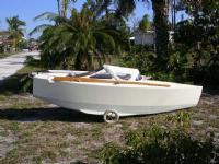
Back Home
Yup, it was good to be home. Till next time...
Further reading: Look for SharkChow's book about the 2006 Ultimate Florida Challenge,
"Without a Paddle: Racing 1,200 Miles Around Florida by Sea Kayak," by Warren Richey,
St. Martin's Press, available June 2010.
Copyright ©2010 Matt Layden
|
|